|
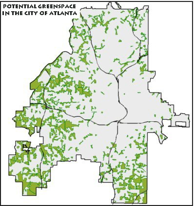
Welcome to the Interactive Mapper, a product of the Greenspace Acquisition Support System designed by the Center for Geographic Information Systems (CGIS) at Georgia Tech. The GIS based greenspace support system is designed to aid Atlanta based non-profits and local governments make sound decisions based in science when targeting land for acquisition as greenspace. Thanks to funding made available by Trees Atlanta and the Turner Foundation, researchers at CGIS have identified, mapped and prioritized potential greenspace areas greater than 5 acres in size within the city limits of Atlanta.
Clicking on the map to the right will direct you to the interactive mapper. The interactive mapper allows users to zoom in to an area of their choice for a close up look at potential greenspace. Once zoomed in, users can identify potential greenspace areas(polygons) by their Identification number. Users can click on the id numbers to see the attribute information for the polygons. The id numbers can also be cross referenced to the accompanying greenspace acquisition support documents,which contain the results of all greenspace analyses, as well as tax and property information for each potential greenspace area (polygon).
The reference page contains interactive mapper instructions, GIS center contact information, and project documentation.
|