Modeling Atlanta's Growth
Smart Design through Advanced Planning
Learn More

Project Overview

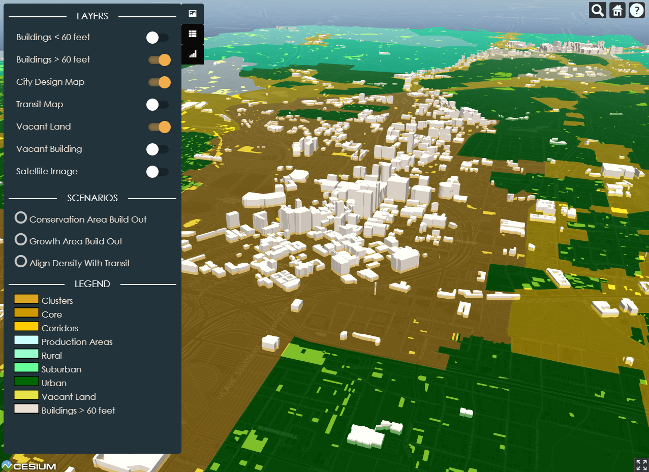
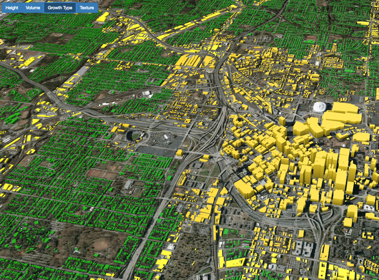
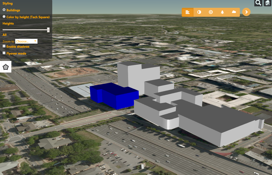
The collaboration between the City of Atlanta and Georgia Tech was borne out of desire for novel planning tools that facilitate the urban design process. The result of this partnership is a set of interactive applications that extend the utility of geospatial data and incorporate advanced modeling techniques – allowing for dynamic visualization of build-out scenarios in a browser-based 3D environment.

  • 2015-2016

    Project Beginnings

    Consideration of the different utilities of GIS and visual modeling tools as applied to city build-out and data-driven planning spurs collaboration between the City of Atlanta and Georgia Tech's School of City and Regional Planning.

  • 2016-2017

    Development of Alternatives

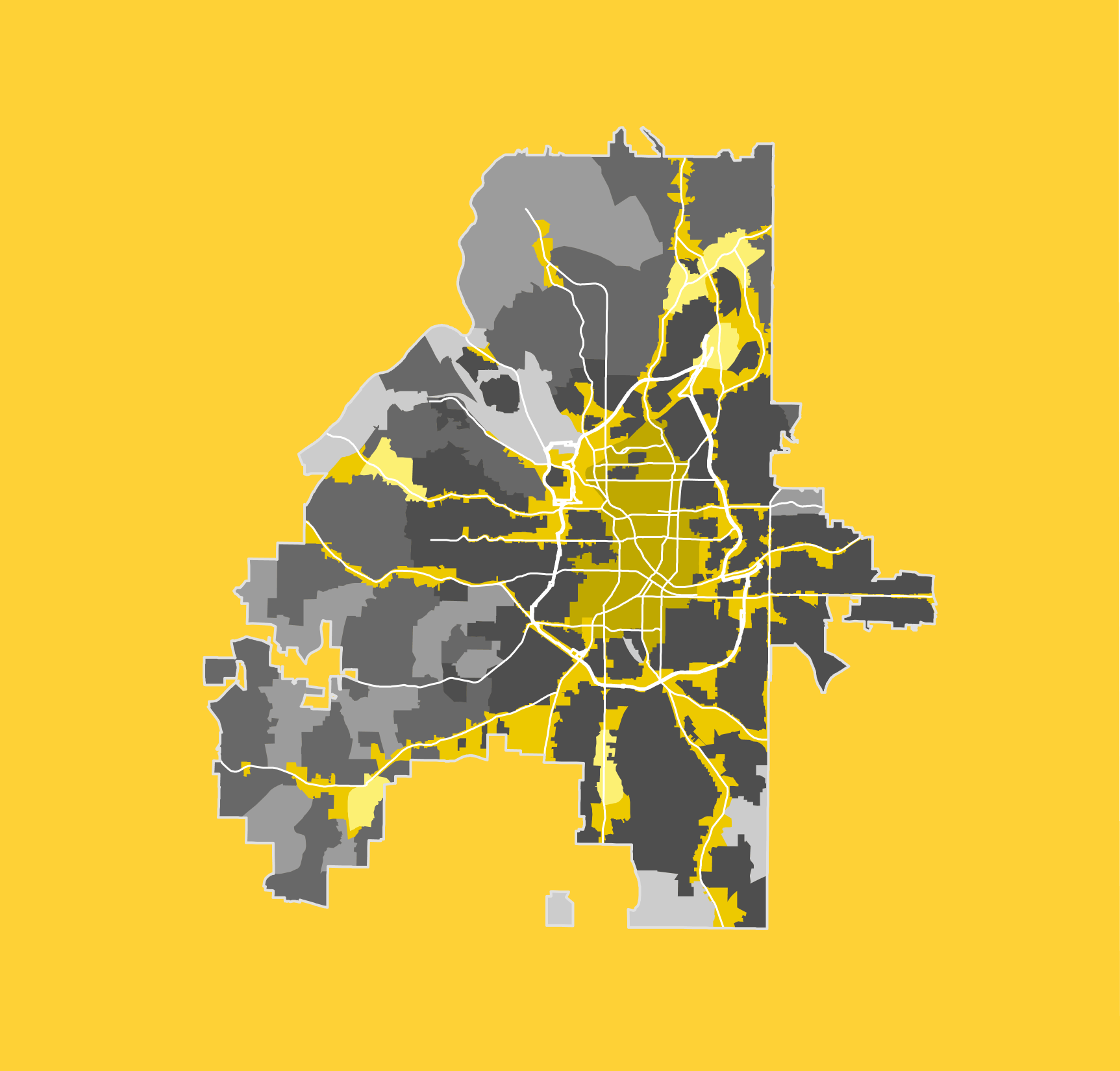
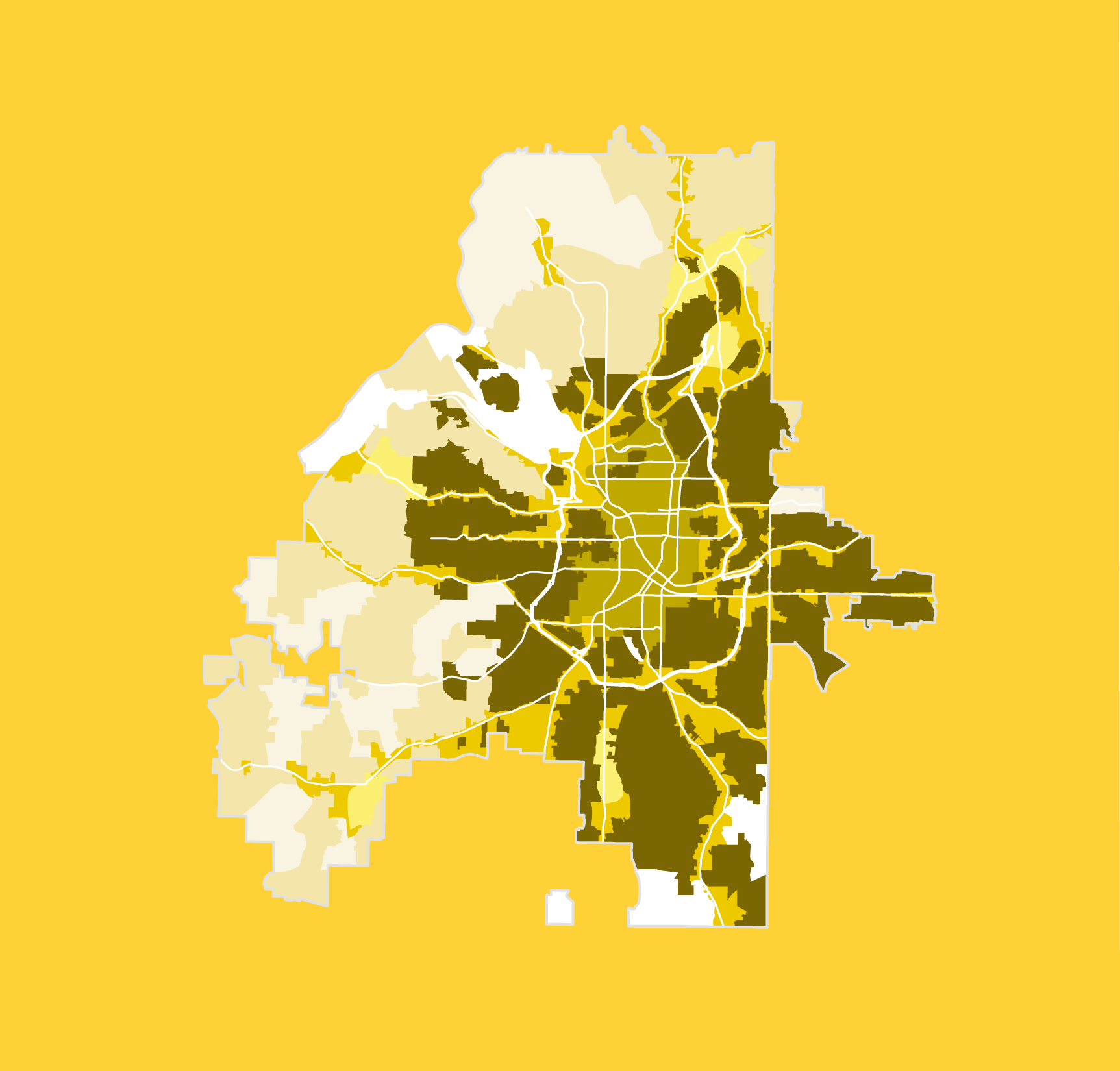
    Scenarios focusing on various aspects of development and conservation are designed. Scenarios are focused on altering zoning parameters, targeting of specific areas for development, and promoting infill.

  • 2017-2018

    Scenario Assessment

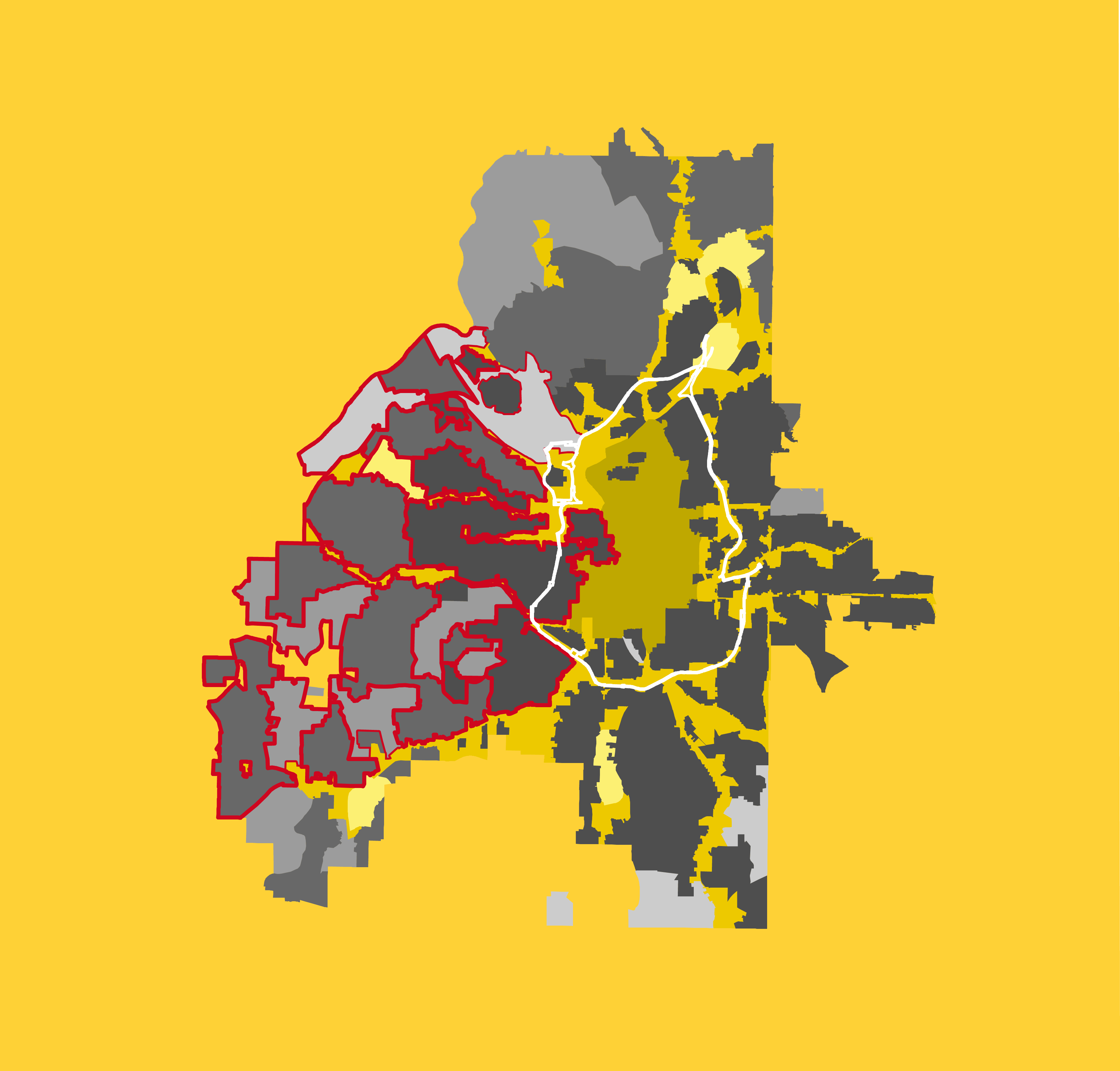
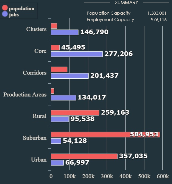
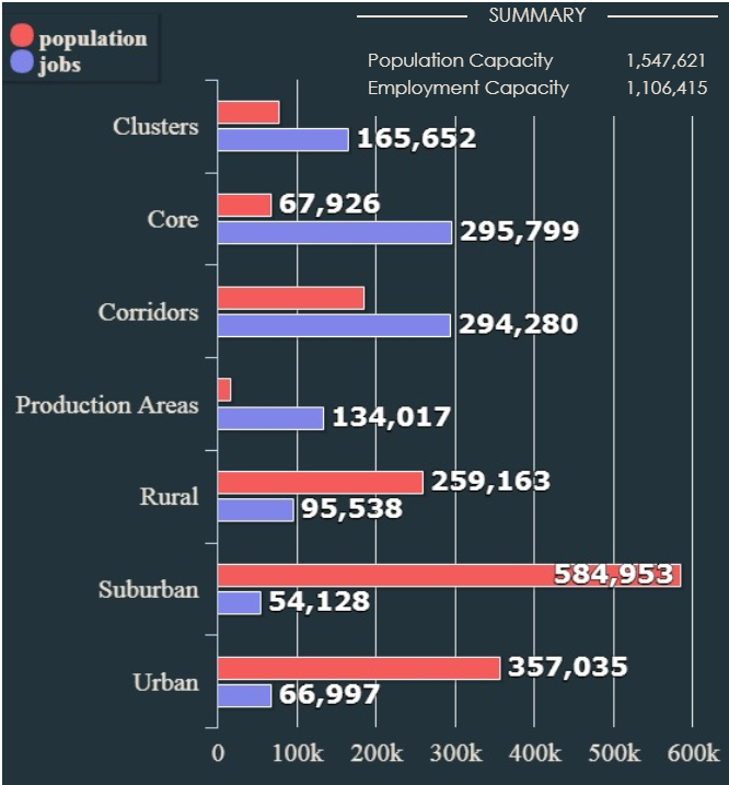
    Outcomes are compared to the Do Nothing alternative to analyze benefits and identify areas for continued improvement. Additional data and directed input is obtained from stakeholders.

  • 2018-2019

    Application of Results

    The results from finalized scenarios are used to inform better planning decisions, conservation efforts, and targeted development. Tools used in the decision making process are made publically available.

Planning Tools

Visualization and planning tools developed for assessing Growth Scenarios. Select one of the tools below to open a browser-based 3D visualization suite. Please allow time for pages to load as the applications are data intensive.

Atlanta Interactive Design (AID)

Explore different growth scenarios and build-out possibilities in 3D, and view resulting statistics.

Atlanta City Viewer

Visualize Atlanta’s buildings based on height, volume, growth type, and texture. (Scenario Viewer)

Atlanta City Editor

Editing tool for creation, change, and visualization of potential buildings in Atlanta.

Take a look at the "Getting Started" section of the help and documentation for information on using the planning tools.

The provided suite of planning tools are accessible to the general public and free to use. Built using a combination of 2D and 3D geospatial and remote sensing data, these apps provide renderings of the current cityscape and enable users to visualize changes in the city with different planning policies. Comparison of potential build-out scenarios in the Atlanta metro area is possible by changing parameters in each Growth Area.

Featured Scenarios

Guided Development Alternatives for the City of Atlanta

Conservation Area Build-Out

- Scenario 1 -

Vacant land and buildings in the Conservation areas (Urban, Suburban, Rural, and Production) are built out and totals added to the baseline estimates.

Growth Area Build-Out

- Scenario 2 -

Vacant land and buildings in both Growth (Core, Corridor, Clusters) and Conservation areas are built out and population and job totals are added to the baseline estimates.

Align Density with Transit

- Scenario 3 -

Scenario two, with increased transit-driven densities in Growth Areas (Core, Corridor, Clusters).

Meet the Project Team

CGIS Research Members

Tony Giarrusso

Associate Director

Gordon Zhang

Research Scientist

Matthew Swarts

Research Scientist

For nearly 20 years, the Center for Spatial Planning Analytics and Visualization (previously the Center for Geographic Information Systems - CGIS) has been at the forefront of collaborative interdisciplinary research for local, state, national, nonprofit, and private entities across the nation and the globe.