Resources
Click an image below to visit one of the ArcGIS Online maps, Story Maps, or articles about our greenspace and urban tree canopy studies.
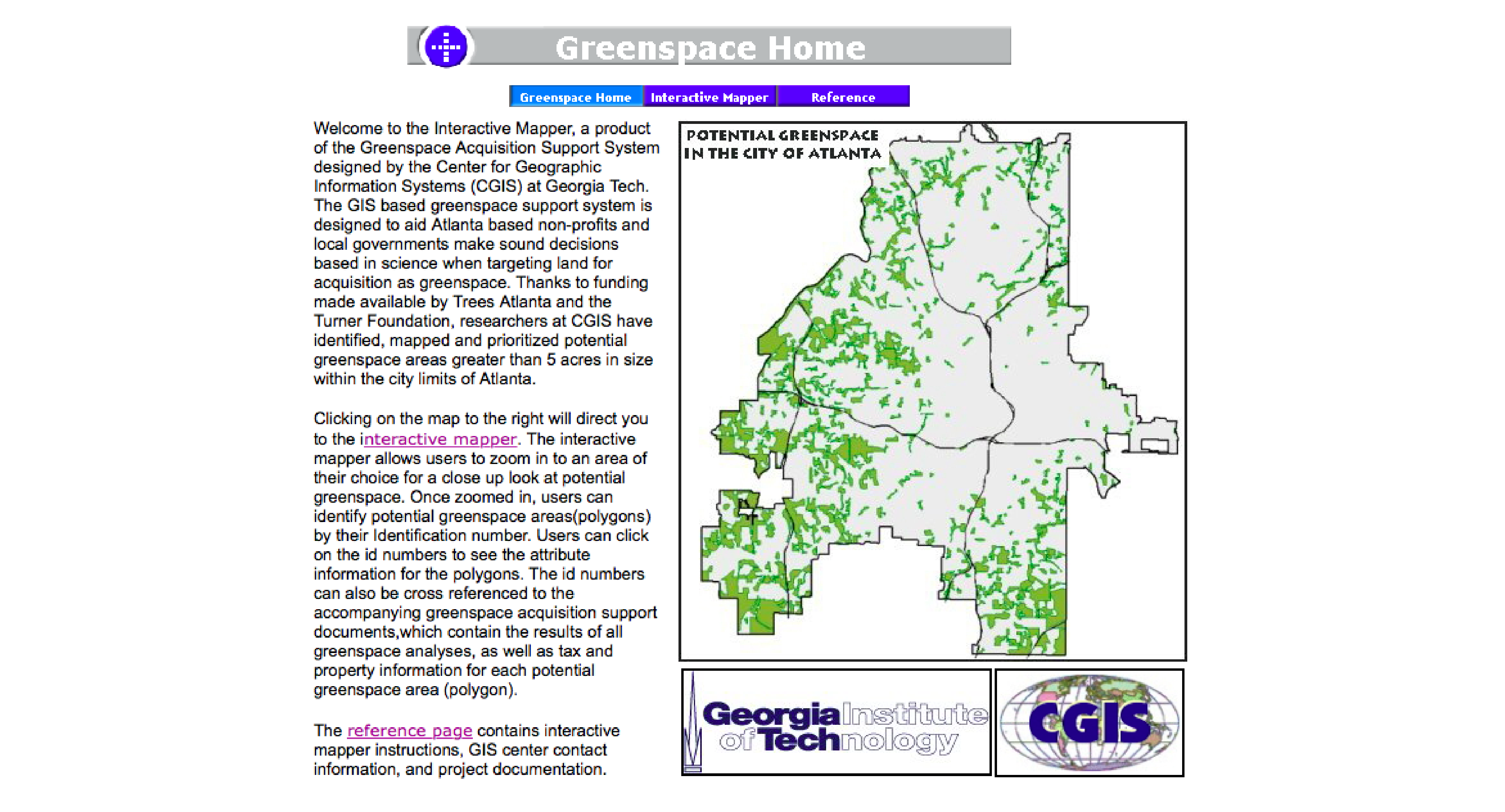
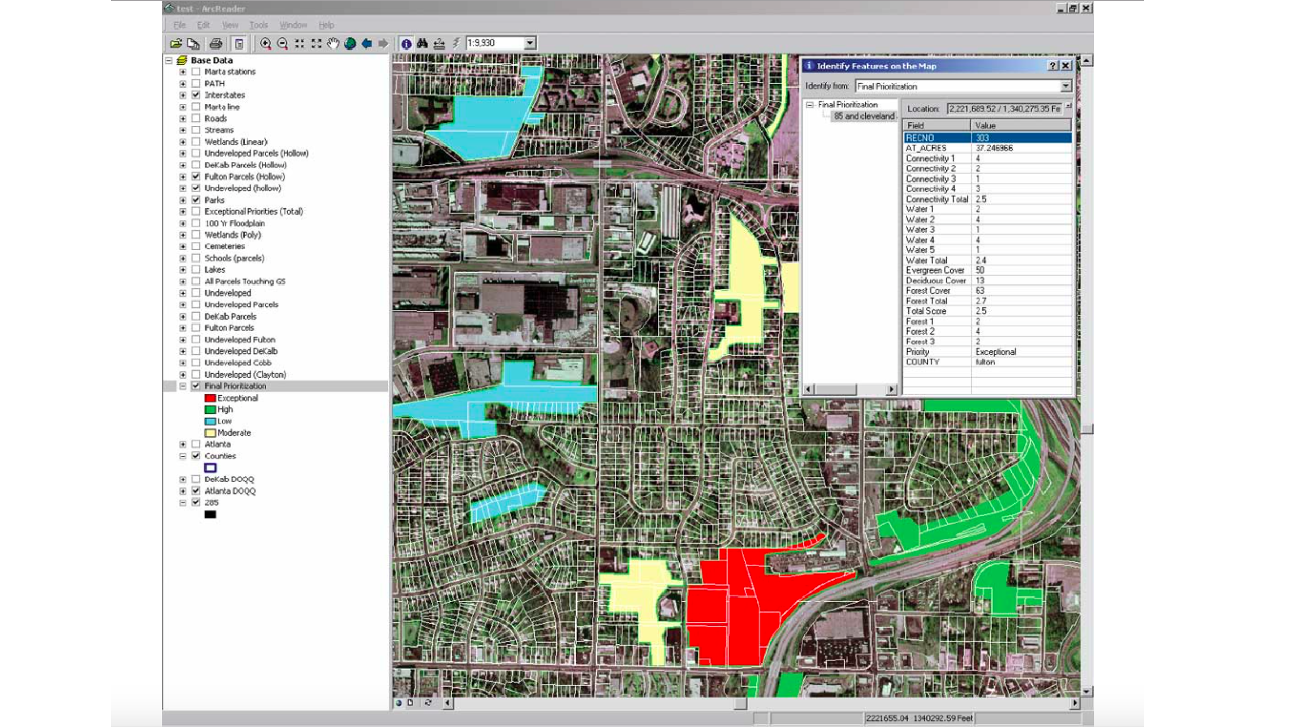
Greenspace Support System
The Greenspace Support System interactive map shows environmentally-ranked, potential greenspaces identified within the city of Atlanta in 1999.
Greenspace Support System Article
This 2003 article in ESRI's ArcUser magazine details the methods, parameters, and results of the Greenspace Support System.
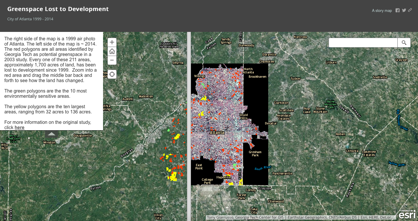
Greenspace Lost to Development
This interactive slider StoryMap allows you to scroll back and forth between the years 1999 and 2014 in order to compare greenspace areas betwween time periods.
Urban Tree Canopy Assessments
This website contains results from each of the City of Atlanta's urban tree canopy assessments. StoryMaps, data dashboards, interactive maps and reports are available. Check it out!
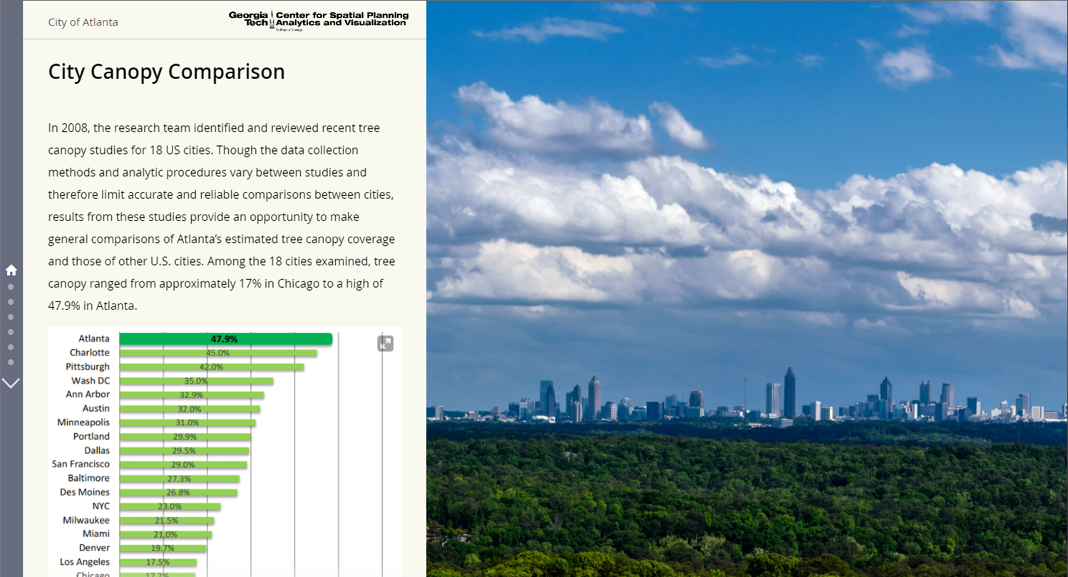
UTC City Comparison StoryMap
Want to see how Atlanta's urban tree canopy stacks up next to other major U.S. cities? Scroll through this StoryMap to see how Atlanta compares to other cities across the nation.
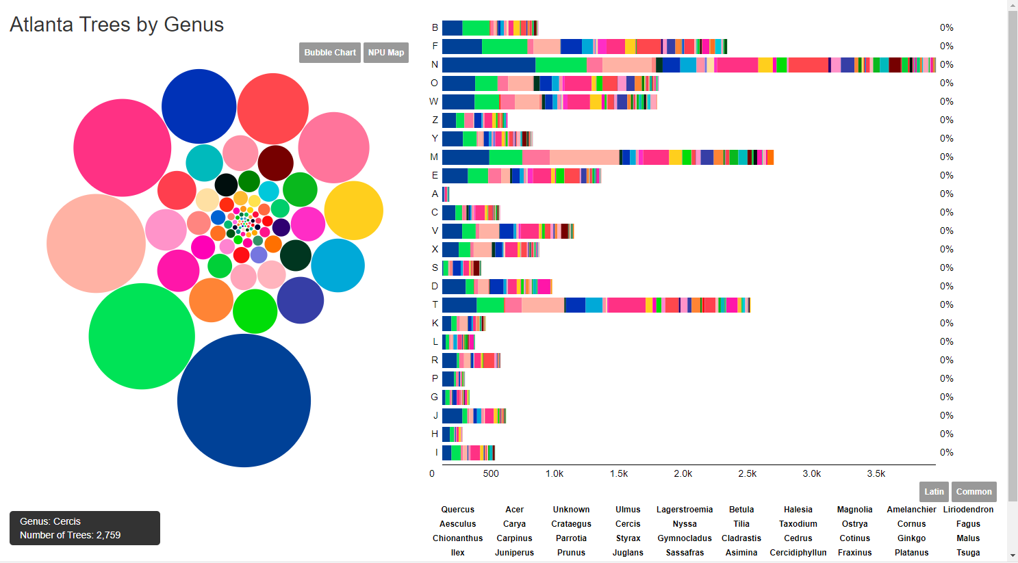
Atlanta Street Tree Diversity
This interactive visualization allows you to see the species diversity of trees planted by Trees Atlanta pre-2015 by Neighborhood Planning Unit. .
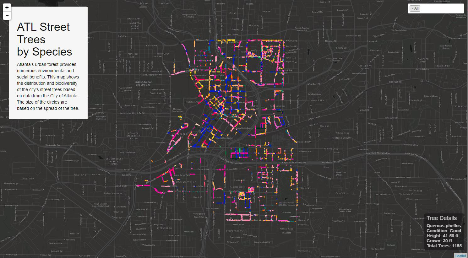
Trees Atlanta Trees
Check out this interactive map showing the distribution and biodiversity of the city's street trees based on data from Trees Atlanta in 2015.
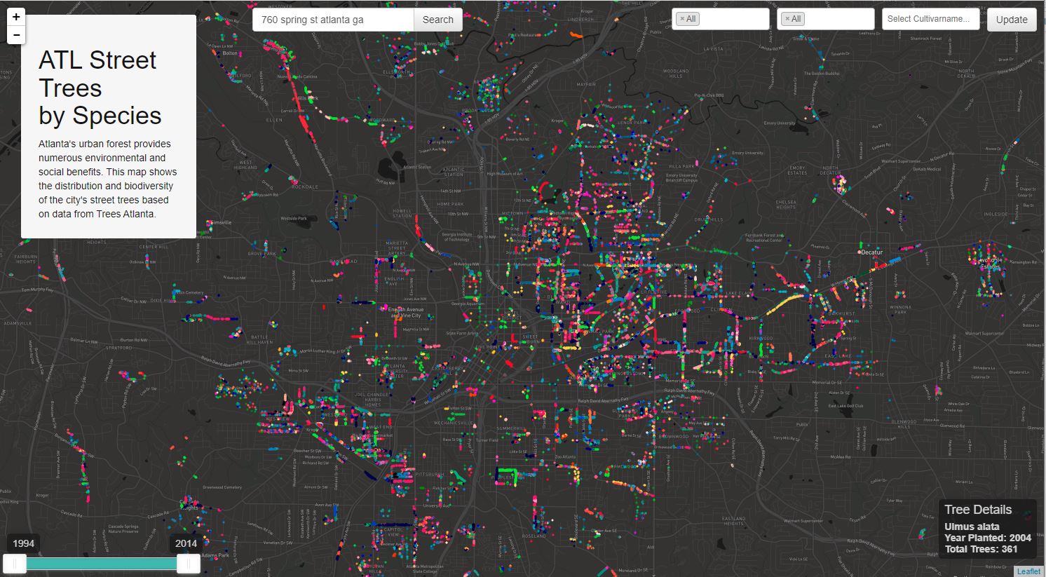
Atlanta Street Trees
Check out this map showing the distribution and biodiversity of the city's street trees based on data from the City of Atlanta Street Tree Inventory.

Trees Atlanta Interactive Map
Check out this interactive tree inventory map by Trees Atlanta, where you view the trees Trees Atlanta has planted or maintained.