Example
of Color and Codes for Potential Greenspace Maps used in the Interactive Mapper
![]()
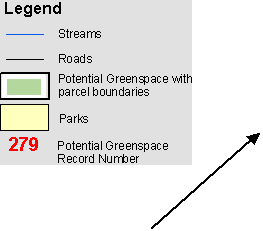
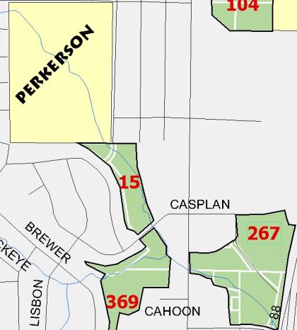
·
 Black text in yellow polygons

![]() are park names
are park names
· Green represents potential
greenspace
polygons
·
White lines are parcel
 boundaries within the potential
greenspace polygons
·
![]()
 Black lines and text are roads
and road names
· Blue lines and polygons are
water bodies
· Red numbers correspond to record numbers of potential greenspace polygons. Clicking on these numbers will bring up the attribute information for the potential greenspace polygon in the same browser window. These numbers alosl allow one to cross reference a potential greenspace polygon with it’s attributes listed in one of the accompanying analysis reference manuals. Red numbers are either inside or next to a potential greenspace polygon.